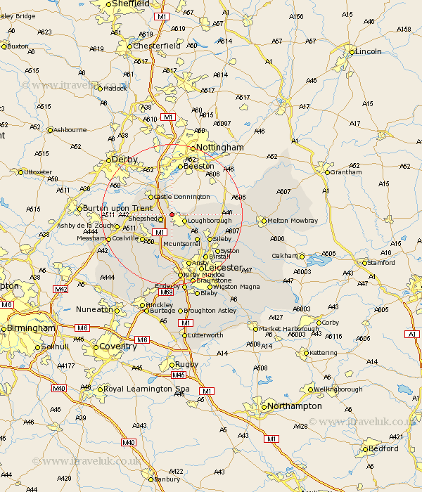
Leicestershire Map Showing Location of Hathern
Population: 1750
Area Size (ha): 54
District: Charnwood
Easting: 450579 Northing: 320936
Latitude: 52.78 Longitude: -1.25
 = Hathern
Area Size (ha): 54
District: Charnwood
Easting: 450579 Northing: 320936
Latitude: 52.78 Longitude: -1.25
= Hathern
This Hathern map below is supplied by Google. Use the tools in the top left corner to zoom into street level or zoom out for a road map, you may also need to zoom in to see Hathern on the map. Click and drag the map to move around. If the map fails to load try and refresh your browser or zoom in or out (+ or -).
Update - it seems Google no longer allow people to use their maps for free! This Hathern map sometimes loads and sometimes gives a error. I am working on a solution.
Closest 30 Towns or Cities to Hathern (Population over 500)
Hathern 0km Sheepshed 3.27km Shepshed 3.27km Loughborough 3.84km Kegworth 3.88km Belton 5.9km Diseworth 5.9km Castle Donington 7.89km Castle Donnington 7.89km Quorndon 7.9km Woodhouse 8.13km Barrow upon Soar 8.73km Barrow 8.73km Swannington 8.73km Burton on the Wolds 9.16km Burton 9.16km Burton-on-the-Wolds 9.16km Mountsorrel 10.01km Wimeswould 10.09km Wymeswold 10.09km Breedon on the Hill 10.09km Breedon-on-the-Hill 10.09km Breedon 10.09km Worthington 10.26km Coleorton 10.75km Coalville 10.8km Rothley 12.14km Sileby 12.52km Markfield 13.16km Ravenstone 13.7km