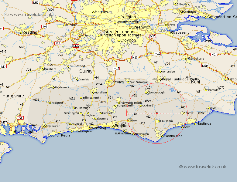
Sussex Map Showing Location of Horam
Population: 1916
Area Size (ha): 58
District: Wealden
Easting: 558140 Northing: 115498
Latitude: 50.92 Longitude: 0.25
 = Horam
Area Size (ha): 58
District: Wealden
Easting: 558140 Northing: 115498
Latitude: 50.92 Longitude: 0.25
= Horam
This Horam map below is supplied by Google. Use the tools in the top left corner to zoom into street level or zoom out for a road map, you may also need to zoom in to see Horam on the map. Click and drag the map to move around. If the map fails to load try and refresh your browser or zoom in or out (+ or -).
Update - it seems Google no longer allow people to use their maps for free! This Horam map sometimes loads and sometimes gives a error. I am working on a solution.
Closest 30 Towns or Cities to Horam (Population over 500)
Horam 0km Horeham 0km Warbleton 2.98km Heathfield 3.88km Chiddingly 5.03km Hellingly 5.56km Hailsham 5.68km East Hoathly 5.84km Hurstmonceux 6.92km Herstmonceux 6.92km Hurstmonceaux 6.92km Hadlow Down 8.76km Framfield 8.98km Laughton 8.99km Mayfield 9.26km Chalvington 10.21km Buxted 11.03km Uckfield 11.89km Ninfield 12.95km Isfield 12.98km Polegate 13.03km Burwash 13.15km Rotherfield 13.17km Ringmer 13.38km Maresfield 13.83km Catsfield 14.51km Alfriston 14.75km Pevensey 14.75km Jevington 15.02km Mountfield 15.3km