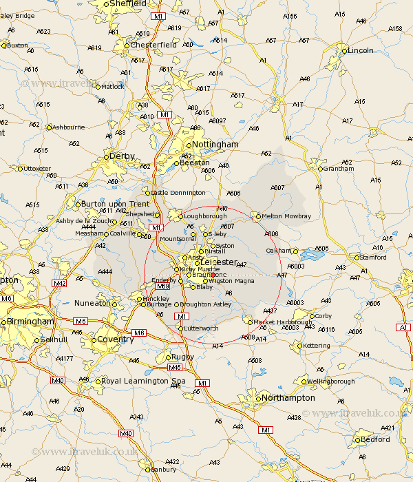
Leicestershire Map Showing Location of Evington
Easting: 463206 Northing: 300694
Latitude: 52.6 Longitude: -1.07
 = Evington
Latitude: 52.6 Longitude: -1.07
= Evington
This Evington map below is supplied by Google. Use the tools in the top left corner to zoom into street level or zoom out for a road map, you may also need to zoom in to see Evington on the map. Click and drag the map to move around. If the map fails to load try and refresh your browser or zoom in or out (+ or -).
Update - it seems Google no longer allow people to use their maps for free! This Evington map sometimes loads and sometimes gives a error. I am working on a solution.
Closest 30 Towns or Cities to Evington (Population over 500)
Oadby 2.17km Wigston Magna 2.92km Wigston 2.92km Great Glen 4.33km Glen Parka 5.01km Glen Parva 5.01km Leiscester 5.83km Leicester 5.83km Houghton on the Hill 5.93km Houghton 5.93km Houghton-on-the-Hill 5.93km Blaby 6.74km Braunstone 6.75km Countesthorpe 7.16km Birstall 8.14km Whetstone 8.71km Billesdon 9.01km Enderby 9.2km Syston 9.26km Kibworth Harcourt 9.31km Kibworth 9.31km Queniborough 9.53km Queniboro 9.53km Anstey 9.64km Ansty 9.64km Cosby 9.65km Narborough 9.74km Kirby Muxloe 10.3km Rothley 11.99km Twyford 12.55km