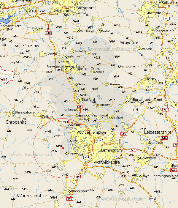
Staffordshire Map Showing Location of Enville
Population: 477
District: South Staffordshire
Easting: 381892 Northing: 287338
Latitude: 52.48 Longitude: -2.27
 = Enville
District: South Staffordshire
Easting: 381892 Northing: 287338
Latitude: 52.48 Longitude: -2.27
= Enville
This Enville map below is supplied by Google. Use the tools in the top left corner to zoom into street level or zoom out for a road map, you may also need to zoom in to see Enville on the map. Click and drag the map to move around. If the map fails to load try and refresh your browser or zoom in or out (+ or -).
Update - it seems Google no longer allow people to use their maps for free! This Enville map sometimes loads and sometimes gives a error. I am working on a solution.
Closest 30 Towns or Cities to Enville (Population over 500)
Bobbington 3.88km Kinvere 4.34km Wombourn 7.92km Wombourne 7.92km Himley 8.73km Scisdon 9.34km Seisdon 9.34km Lower Penn 10.31km Pattingham 11.12km Dudley 12.55km Wolverhampton 14.32km Bilston 16.4km Codsall 17.28km Smethwick 18.15km West Bromwich 18.43km Wallsall 22.22km Walsall 22.22km Brewood 23.24km Shareshill 23.86km Weston under Lizard 24.12km Weston 24.12km Weston-under-Lizard 24.12km Rushall 25.04km Blymhill 25.98km Pelsall 26.05km Wheaton Aston 26.17km Wyrley 26.71km Great Wyrley 26.71km Aldridge 26.99km Cannock 27.93km