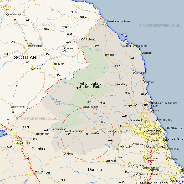
Northumberland Map Showing Location of Elrington
District: Tynedale
Easting: 387191 Northing: 561732
Latitude: 54.95 Longitude: -2.2
 = Elrington
Easting: 387191 Northing: 561732
Latitude: 54.95 Longitude: -2.2
= Elrington
This Elrington map below is supplied by Google. Use the tools in the top left corner to zoom into street level or zoom out for a road map, you may also need to zoom in to see Elrington on the map. Click and drag the map to move around. If the map fails to load try and refresh your browser or zoom in or out (+ or -).
Update - it seems Google no longer allow people to use their maps for free! This Elrington map sometimes loads and sometimes gives a error. I am working on a solution.
Closest 30 Towns or Cities to Elrington (Population over 500)
Haydon Bridge 2.82km Warden 5.64km Newbrough 5.66km Hexham 6.65km Acomb 7.38km Humshaugh 10.19km Sandhoe 10.27km Challerton 11.25km Chollerton 11.25km Corbridge 11.85km Slaley 12.01km Wark 13.02km Riding 15.02km Ridingmill 15.02km Haltwhistle 15.35km Stocksfield 18.19km Ovingham 21.36km Bellingham 22.34km Prudhoe 22.35km Wylam 22.42km Stamfordham 23.19km Otterburn 29.73km Newburn 29.85km Ponteland 30.78km Woolsington 33.79km Dinnington 34.78km Gosforth 37.64km Stannington 37.87km Newcastle on Tyne 38.35km Newcastle upon Tyne 38.35km