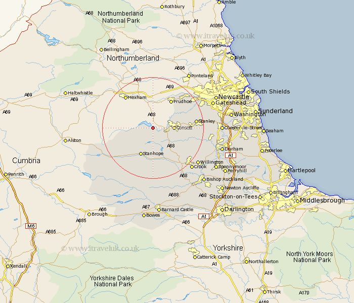
Durham Map Showing Location of Edmondbyers
Population: 155
District: Derwentside
Easting: 403210 Northing: 550588
Latitude: 54.85 Longitude: -1.95
 = Edmondbyers
District: Derwentside
Easting: 403210 Northing: 550588
Latitude: 54.85 Longitude: -1.95
= Edmondbyers
This Edmondbyers map below is supplied by Google. Use the tools in the top left corner to zoom into street level or zoom out for a road map, you may also need to zoom in to see Edmondbyers on the map. Click and drag the map to move around. If the map fails to load try and refresh your browser or zoom in or out (+ or -).
Update - it seems Google no longer allow people to use their maps for free! This Edmondbyers map sometimes loads and sometimes gives a error. I am working on a solution.
Closest 30 Towns or Cities to Edmondbyers (Population over 500)
Castleside 5.65km Consett 7.47km Consetti 7.47km Leadgate 9.78km Stanhope 11.91km Annfield Plain 13.87km Cornsay 13.89km Lanchester 14.36km Wolsingham 15.43km Tow Law 15.54km Stanley 15.63km Rowlands Gill 15.72km Burnopfield 15.93km Esh 17.65km Langley Park 18.98km Whickham 19.41km Edmondsley 20.27km Blaydon 20.59km Ushaw Moor 20.6km Witton Gilbert 21.03km Sacriston 21.67km Crook 21.71km Willington 21.83km Ouston Moor 22.17km Ouston 22.17km Pelton 22.48km Lamesley 23.58km Gateshead on Tyne 23.74km Gateshead-on-Tyne 23.74km Gateshead 23.74km