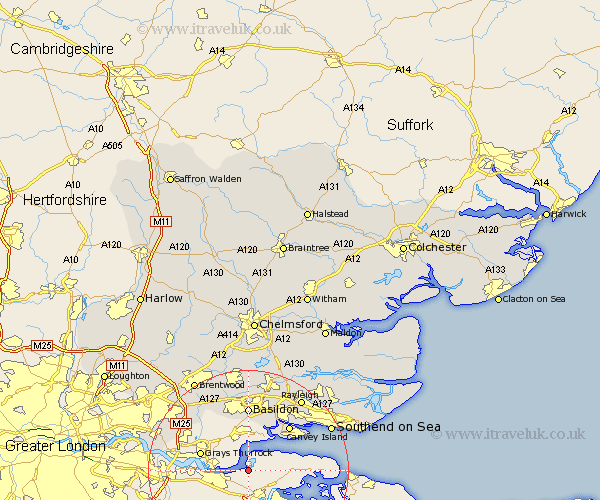
Essex Map Showing Location of East Tilbury
Easting: 571377 Northing: 175275
Latitude: 51.45 Longitude: 0.47
 = East Tilbury
Latitude: 51.45 Longitude: 0.47
= East Tilbury
This East Tilbury map below is supplied by Google. Use the tools in the top left corner to zoom into street level or zoom out for a road map, you may also need to zoom in to see East Tilbury on the map. Click and drag the map to move around. If the map fails to load try and refresh your browser or zoom in or out (+ or -).
Update - it seems Google no longer allow people to use their maps for free! This East Tilbury map sometimes loads and sometimes gives a error. I am working on a solution.
Closest 30 Towns or Cities to East Tilbury (Population over 500)
Stanford le Hope 6.55km Tilbury Fort 6.93km Tilbury 6.93km Corringham 7.84km Grays Thurrock 9.95km Grays 9.95km South Benfleet 10.91km Benfleet 10.91km Canvey Island 12.29km South Ockedon 12.81km South Ockendon 12.81km Basildon 12.98km Great Burstead 15.22km Aveley 15.46km Wickford 17.03km Herongate 17.44km Ingrave 17.46km Leigh 17.76km Leigh-on-Sea 17.76km Leigh on Sea 17.76km Rawreth 18.06km Rayleigh 18.09km Ramsden Heath 18.57km Southend 18.62km Southend on Sea 18.62km Southend-on-Sea 18.62km Billericay 18.86km Hockley 19.51km Hawkwell 20.28km South Hanningfield 20.67km