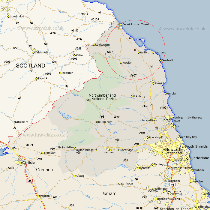
Northumberland Map Showing Location of Detchant
District: Berwick-upon-Tweed
Easting: 408396 Northing: 635908
Latitude: 55.62 Longitude: -1.87
 = Detchant
Easting: 408396 Northing: 635908
Latitude: 55.62 Longitude: -1.87
= Detchant
This Detchant map below is supplied by Google. Use the tools in the top left corner to zoom into street level or zoom out for a road map, you may also need to zoom in to see Detchant on the map. Click and drag the map to move around. If the map fails to load try and refresh your browser or zoom in or out (+ or -).
Update - it seems Google no longer allow people to use their maps for free! This Detchant map sometimes loads and sometimes gives a error. I am working on a solution.
Closest 30 Towns or Cities to Detchant (Population over 500)
Belford 2.8km Lowick 6.54km Ancroft 12.48km Wooler 12.5km North Sunderland 13.74km Beadnell 16.43km Ord 17.55km East Ord 17.55km Berwick upon Tweed 20.33km Berwick-Upon-Tweed 20.33km Berwick on Tweed 20.33km Berwick 20.33km Berwick-upon-Tweed 20.33km Berwick-on-Tweed 20.33km Norham 20.96km Embleton 21.62km Almwick 26.28km Alnwick 26.28km Alnmouth 29.37km Shilbottle 30.1km Lesbury 30.36km Lisburg 30.36km Rothbury 33.42km Warkworth 33.58km Swarland 36.2km Amble 36.22km Longframlington 37.44km Felton 38.53km East Thirston 38.83km Thirston 38.83km