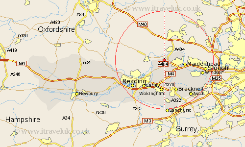
Berkshire Map Showing Location of Hurley
Population: 1854
Easting: 482069 Northing: 182319
Latitude: 51.53 Longitude: -0.82
 = Hurley
Easting: 482069 Northing: 182319
Latitude: 51.53 Longitude: -0.82
= Hurley
This Hurley map below is supplied by Google. Use the tools in the top left corner to zoom into street level or zoom out for a road map, you may also need to zoom in to see Hurley on the map. Click and drag the map to move around. If the map fails to load try and refresh your browser or zoom in or out (+ or -).
Update - it seems Google no longer allow people to use their maps for free! This Hurley map sometimes loads and sometimes gives a error. I am working on a solution.
Closest 30 Towns or Cities to Hurley (Population over 500)
Bisham 3.92km Remenham 4.61km Wagrave 6.55km Wargrave 6.55km White Waltham 6.55km Waltham Saint Lawrence 7.5km Waltham St Lawrence 7.5km Waltham St. Lawrence 7.5km Twyford 7.76km Cookham 8.28km Maidenhead 8.28km Bray 8.88km Sonning 9.39km Woodley 10.35km Binfield 11.36km Wokingham 13.02km Winnersh 13.42km Winkfield 13.75km Earley 13.75km Bracknell 13.77km Warfield 14.2km Eton 15.44km Windsor 15.99km New Windsor 15.99km Stoke Poges 16.25km Arborfield 16.36km Aberfield 16.36km Slough 16.57km Frogmore 16.73km Frogmore House 16.73km