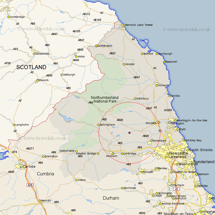
Northumberland Map Showing Location of Capheaton
Population: 160
District: Castle Morpeth
Easting: 403190 Northing: 578405
Latitude: 55.1 Longitude: -1.95
 = Capheaton
District: Castle Morpeth
Easting: 403190 Northing: 578405
Latitude: 55.1 Longitude: -1.95
= Capheaton
This Capheaton map below is supplied by Google. Use the tools in the top left corner to zoom into street level or zoom out for a road map, you may also need to zoom in to see Capheaton on the map. Click and drag the map to move around. If the map fails to load try and refresh your browser or zoom in or out (+ or -).
Update - it seems Google no longer allow people to use their maps for free! This Capheaton map sometimes loads and sometimes gives a error. I am working on a solution.
Closest 30 Towns or Cities to Capheaton (Population over 500)
Stamfordham 9.12km Chollerton 12.09km Challerton 12.09km Humshaugh 13.83km Ponteland 13.89km Sandhoe 14.46km Corbridge 15.42km Ovingham 15.74km Acomb 16.12km Wylam 16.13km Wark 17.37km Warden 17.46km Hexham 17.64km Prudhoe 17.86km Dinnington 17.86km Stannington 18.03km Morpeth 18.5km Newbrough 18.56km Ridingmill 18.57km Riding 18.57km Stocksfield 18.66km Longhorsley 18.85km Bellingham 18.85km Otterburn 18.92km Hebron 19.31km Woolsington 19.34km Hepscott 19.87km Newburn 20.26km Pegswood 21.45km Slaley 22.87km