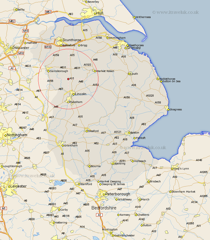
Lincolnshire Map Showing Location of Ingham
Population: 857
District: West Lindsey
Easting: 494327 Northing: 382786
Latitude: 53.33 Longitude: -0.58
 = Ingham
District: West Lindsey
Easting: 494327 Northing: 382786
Latitude: 53.33 Longitude: -0.58
= Ingham
This Ingham map below is supplied by Google. Use the tools in the top left corner to zoom into street level or zoom out for a road map, you may also need to zoom in to see Ingham on the map. Click and drag the map to move around. If the map fails to load try and refresh your browser or zoom in or out (+ or -).
Update - it seems Google no longer allow people to use their maps for free! This Ingham map sometimes loads and sometimes gives a error. I am working on a solution.
Closest 30 Towns or Cities to Ingham (Population over 500)
Scrampton 3.86km Scampton 3.86km Willingham 6.89km Welton 7.61km Dunholme 8.59km Dunholm 8.59km Saxilby 8.63km Nettleham 9.95km Marton 10.13km Scothern 10.46km Skellingthorpe 11.34km Torksey 11.41km Sudbrooke 11.55km Lincoln 11.61km Lea 11.67km Gainesborough 13.38km Gainsborough 13.38km Waddingham 13.71km Blyton 14.21km Kirton in Lindsey 14.87km Kirton 14.87km Fiskerton 14.94km Reepham 14.94km Washingborough 15.11km Cherry Willingham 15.15km Morton 15.2km Middle Rasen 15.42km Scotton 15.48km Hykeham 16.67km North Hykeham 16.67km