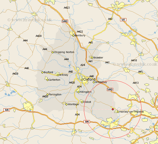
Oxfordshire Map Showing Location of Bix
Population: 531
District: South Oxfordshire
Easting: 472795 Northing: 184032
Latitude: 51.55 Longitude: -0.95
 = Bix
= Bix
District: South Oxfordshire
Easting: 472795 Northing: 184032
Latitude: 51.55 Longitude: -0.95
= Bix
This Bix map below is supplied by Google. Use the tools in the top left corner to zoom into street level or zoom out for a road map, you may also need to zoom in to see Bix on the map. Click and drag the map to move around. If the map fails to load try and refresh your browser or zoom in or out (+ or -).
Update - it seems Google no longer allow people to use their maps for free! This Bix map sometimes loads and sometimes gives a error. I am working on a solution.
Closest 30 Towns or Cities to Bix (Population over 500)
Rotherfield Peppard 2.19km Nettlebed 2.96km Henley on Thames 3.92km Henley-on-Thames 3.92km Harpsden 5.07km Nuffield 6.05km Shiplake 8.18km Ewelme 9.79km Watlington 9.88km Whitchurch 11.84km Aston Rowant 12.98km Lewknor 13.03km Goring 13.21km Wallingford 13.84km Cholsey 13.95km Moulsford 13.96km Chalgrove 14.44km Warborough 14.68km Benson 14.78km Chinnor 15.22km Drayton St. Leonard 16.85km Drayton Saint Leonard 16.85km Drayton 16.85km Drayton St Leonard 16.85km Tetsworth 17.03km Dorchester 17.6km Stadhampton 18.13km Great Haseley 18.52km Blewbury 19.59km Hagbourne 19.93km