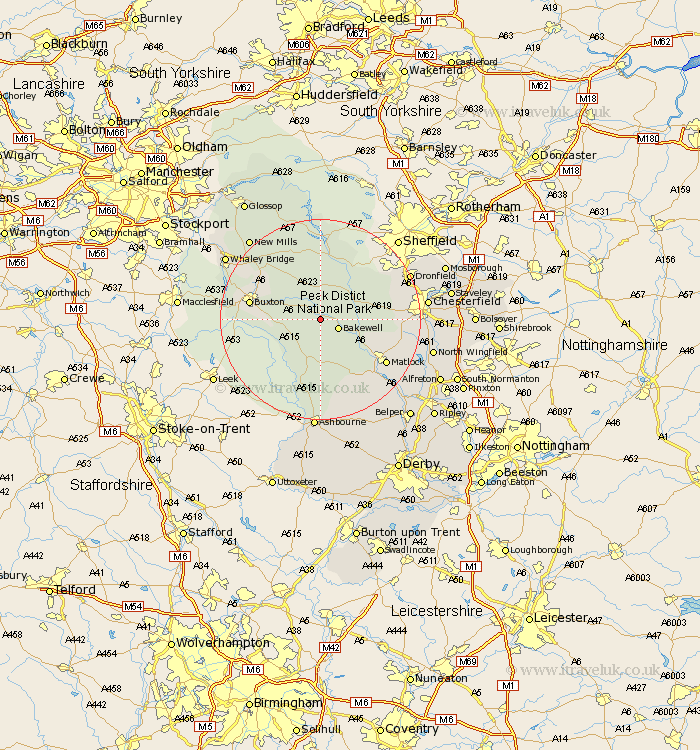
Derbyshire Map Showing Location of Ashford
Population: 497
District: Derbyshire Dales
Easting: 418917 Northing: 368918
Latitude: 53.22 Longitude: -1.72
 = Ashford
District: Derbyshire Dales
Easting: 418917 Northing: 368918
Latitude: 53.22 Longitude: -1.72
= Ashford
This Ashford map below is supplied by Google. Use the tools in the top left corner to zoom into street level or zoom out for a road map, you may also need to zoom in to see Ashford on the map. Click and drag the map to move around. If the map fails to load try and refresh your browser or zoom in or out (+ or -).
Update - it seems Google no longer allow people to use their maps for free! This Ashford map sometimes loads and sometimes gives a error. I am working on a solution.
Closest 30 Towns or Cities to Ashford (Population over 500)
Great Longstone 2.15km Longstone 2.15km Bakewell 3.81km Middleton 5.56km Youlgreave 5.67km Tideswell 6.48km Baslow 6.91km Stony Middleton 7.11km Stoney Middleton 7.11km Eyam 8.12km Grindleford 9.25km Grindleford Bridge 9.25km Darley Dale 9.56km Winster 10.28km Bradwell 11.34km Hathersage 11.97km Castleton 13.39km Buxton 13.82km Bonsall 14.24km Old Brampton 14.54km Brampton 14.54km Hope 14.99km Bamford 14.99km Holmesfield 15.23km Matlock 15.34km Brassington 15.49km Tansley 16.24km Matlock Bath 16.25km Cromford 16.38km Barlow 16.49km