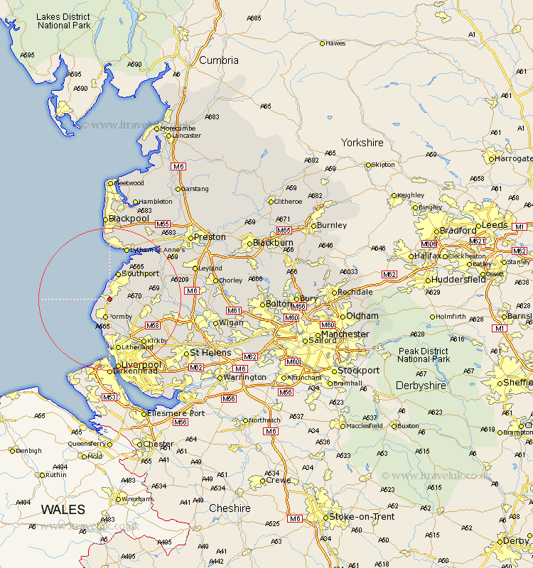
Lancashire Map Showing Location of Ainsdale
District: Sefton
Easting: 331625 Northing: 412015
Latitude: 53.6 Longitude: -3.03
 = Ainsdale
Easting: 331625 Northing: 412015
Latitude: 53.6 Longitude: -3.03
= Ainsdale
This Ainsdale map below is supplied by Google. Use the tools in the top left corner to zoom into street level or zoom out for a road map, you may also need to zoom in to see Ainsdale on the map. Click and drag the map to move around. If the map fails to load try and refresh your browser or zoom in or out (+ or -).
Update - it seems Google no longer allow people to use their maps for free! This Ainsdale map sometimes loads and sometimes gives a error. I am working on a solution.
Closest 30 Towns or Cities to Ainsdale (Population over 500)
Formby 5.67km Halsall 5.8km Scarisbrick 6.6km Southport 7.74km Hightown 9.33km Ince Blundell 9.33km Ormskirk 9.55km Lydiate 10.26km Aughton 10.69km Maghull 10.77km Thornton 11.34km Sefton 11.96km Banks 12.04km Rufford 13.32km Burscough 13.33km Crosby 13.59km Lathom 14.77km Bootle 14.86km Litherland 14.99km Melling 15.09km Tarleton 15.13km Lytham St Anne's 15.46km Lytham Saint Anne's 15.46km Lytham St. Anne's 15.46km Lytham 15.46km Kirkby 15.69km Bickerstaffe 16.13km Aintree 16.23km Bretherton 17.08km Skelmersdale 17.1km