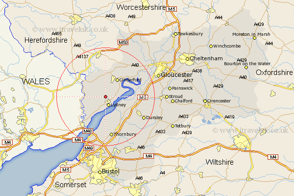
Gloucestershire Map Showing Location of Whitecroft
District: Forest of Dean
Easting: 362036 Northing: 205894
Latitude: 51.75 Longitude: -2.55
 = Whitecroft
Easting: 362036 Northing: 205894
Latitude: 51.75 Longitude: -2.55
= Whitecroft
This Whitecroft map below is supplied by Google. Use the tools in the top left corner to zoom into street level or zoom out for a road map, you may also need to zoom in to see Whitecroft on the map. Click and drag the map to move around. If the map fails to load try and refresh your browser or zoom in or out (+ or -).
Update - it seems Google no longer allow people to use their maps for free! This Whitecroft map sometimes loads and sometimes gives a error. I am working on a solution.
Closest 30 Towns or Cities to Whitecroft (Population over 500)
Bream 1.15km Lydney 3.88km Coleford 6.54km Woolaston 6.54km Newland 7.81km Awre 8.24km Cinderford 8.72km St. Briavels 9.37km Saint Briavels 9.37km St Briavels 9.37km Newham 9.76km Newnham 9.76km Staunton 10.12km Berkeley 10.12km Lydbrook 11.35km Drybrook 11.64km Slimbridge 12.06km Stone 12.51km Frampton on Severn 12.75km Frampton-on-Severn 12.75km Frampton 12.75km Tidenham 13.08km Mitcheldean 13.76km Milcheldean 13.76km Longhope 14.68km Falfield 14.69km North Nibley 14.75km Cam 14.86km Coaley 15.37km Cromhall 16.35km