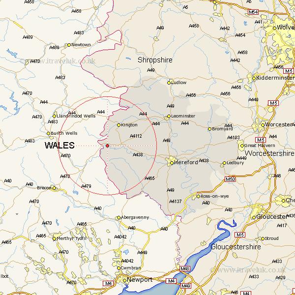
Herefordshire Map Showing Location of Whitney
Easting: 325830 Northing: 247085
Latitude: 52.12 Longitude: -3.08
 = Whitney
Latitude: 52.12 Longitude: -3.08
= Whitney
This Whitney map below is supplied by Google. Use the tools in the top left corner to zoom into street level or zoom out for a road map, you may also need to zoom in to see Whitney on the map. Click and drag the map to move around. If the map fails to load try and refresh your browser or zoom in or out (+ or -).
Update - it seems Google no longer allow people to use their maps for free! This Whitney map sometimes loads and sometimes gives a error. I am working on a solution.
Closest 30 Towns or Cities to Whitney (Population over 500)
Clifford 2.18km Eardisley 5.98km Almeley 7.77km Kington 10.32km Lyonshall 11.5km Peterchurch 13km Weobley 15.8km Dilwyn 16.53km Pembridge 16.73km Madley 18.45km Eardisland 19.41km Credenhill 19.44km Kingstone 20.39km Shobdon 20.93km Burghill 21.71km Wellington 22.83km Ewyas Harold 23.04km Allensmore 23.33km Moreton-on-Lugg 23.97km Moreton on Lugg 23.97km Moreton 23.97km Kingsland 24.35km Hereford 26.13km Bullingham 26.72km Croft 26.76km Leominster 27.16km Much Dewchurch 27.2km Wigmore 27.34km Sutton 27.38km Bodenham 27.55km