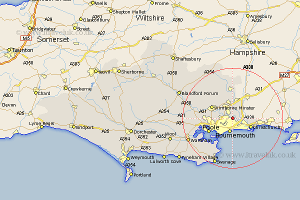
Dorset Map Showing Location of West Parley
Population: 3532
District: East Dorset
Easting: 409401 Northing: 96417
Latitude: 50.77 Longitude: -1.87
 = West Parley
District: East Dorset
Easting: 409401 Northing: 96417
Latitude: 50.77 Longitude: -1.87
= West Parley
This West Parley map below is supplied by Google. Use the tools in the top left corner to zoom into street level or zoom out for a road map, you may also need to zoom in to see West Parley on the map. Click and drag the map to move around. If the map fails to load try and refresh your browser or zoom in or out (+ or -).
Update - it seems Google no longer allow people to use their maps for free! This West Parley map sometimes loads and sometimes gives a error. I am working on a solution.
Closest 30 Towns or Cities to West Parley (Population over 500)
Ferndown 3.7km Fern Down 3.7km Bournemouth 5.68km West Moors 6.03km St Leonards 7.5km Saint Leonards 7.5km St. Leonards 7.5km Christchurch 7.96km Burton 9.01km Wimborne 9.51km Wimborne Minster 9.51km Poole 10.91km Horton 10.96km Verwood 11.12km Corfe Mullen 11.86km Arne 13.88km Sturminster Marshall 14.18km Lytchett Matravers 14.19km Cranborne 15.23km Studland 15.56km Holton Heath 16.23km Holton Heath Station 16.23km Alderholt 16.84km Spetisbury 18.43km Tarrant Monkton 18.85km Corfe Castle 19.67km Swanage 19.83km Wareham 19.89km Langton Matravers 21.34km Worth Matravers 21.94km