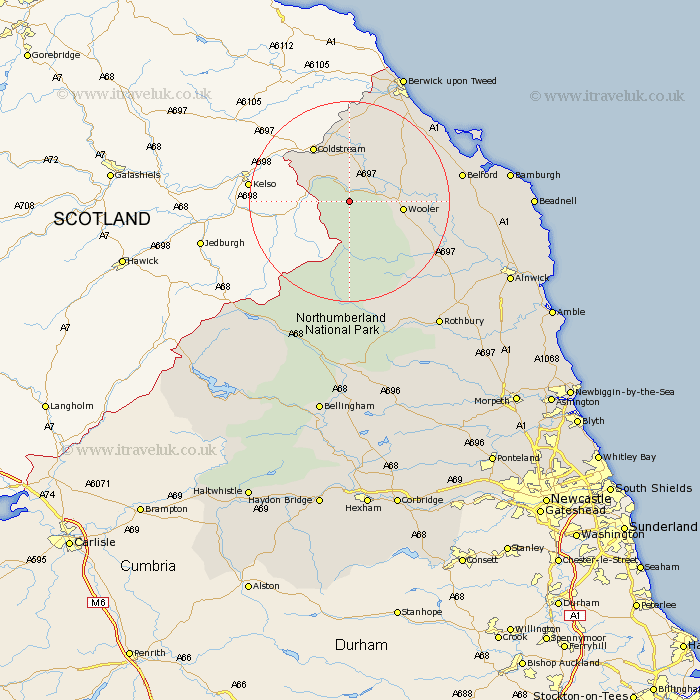
Northumberland Map Showing Location of Westnewton
District: Berwick-upon-Tweed
Easting: 390537 Northing: 628488
Latitude: 55.55 Longitude: -2.15
 = Westnewton
Easting: 390537 Northing: 628488
Latitude: 55.55 Longitude: -2.15
= Westnewton
This Westnewton map below is supplied by Google. Use the tools in the top left corner to zoom into street level or zoom out for a road map, you may also need to zoom in to see Westnewton on the map. Click and drag the map to move around. If the map fails to load try and refresh your browser or zoom in or out (+ or -).
Update - it seems Google no longer allow people to use their maps for free! This Westnewton map sometimes loads and sometimes gives a error. I am working on a solution.
Closest 30 Towns or Cities to Westnewton (Population over 500)
Wooler 9.62km Lowick 14.78km Norham 18.54km Ancroft 19.15km Belford 20.67km East Ord 23.76km Ord 23.76km Berwick-on-Tweed 27.6km Berwick-upon-Tweed 27.6km Berwick 27.6km Berwick on Tweed 27.6km Berwick-Upon-Tweed 27.6km Berwick upon Tweed 27.6km Rothbury 30.36km North Sunderland 30.45km Beadnell 32.5km Almwick 32.9km Alnwick 32.9km Embleton 34.39km Shilbottle 35.79km Otterburn 37.08km Longframlington 37.62km Swarland 38.26km Lisburg 38.39km Lesbury 38.39km Alnmouth 38.47km Warkworth 40.32km Felton 41.06km Thirston 41.8km East Thirston 41.8km