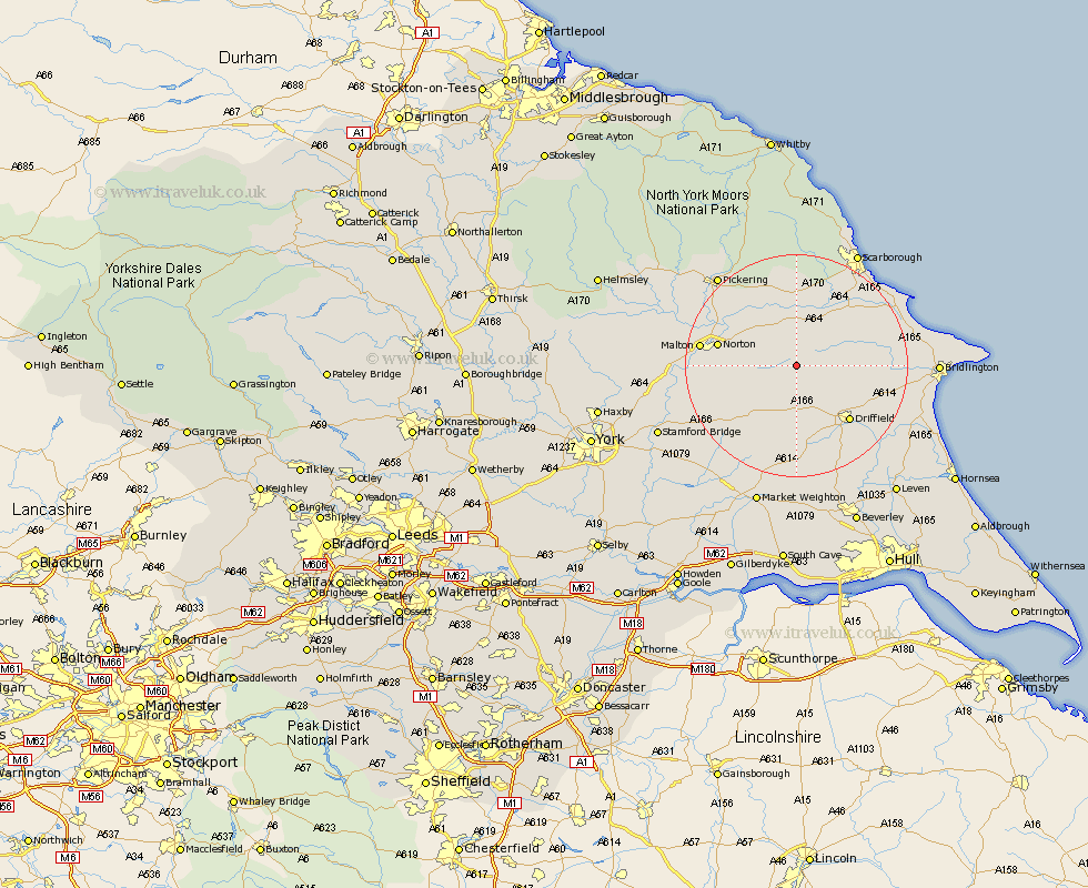
Yorkshire Map Showing Location of West Lutton
District: Ryedale
Easting: 493716 Northing: 468092
Latitude: 54.1 Longitude: -0.57
 = West Lutton
Easting: 493716 Northing: 468092
Latitude: 54.1 Longitude: -0.57
= West Lutton
This West Lutton map below is supplied by Google. Use the tools in the top left corner to zoom into street level or zoom out for a road map, you may also need to zoom in to see West Lutton on the map. Click and drag the map to move around. If the map fails to load try and refresh your browser or zoom in or out (+ or -).
Update - it seems Google no longer allow people to use their maps for free! This West Lutton map sometimes loads and sometimes gives a error. I am working on a solution.
Closest 30 Towns or Cities to West Lutton (Population over 500)
Sherburn 8.1km Great Driffield 8.69km Rillington 10.31km Wetwang 11.12km Yedingham 11.59km Willerby 11.98km Snainton 13.02km Brompton 13.02km Driffield 13.54km Norton 13.66km Kilham 14.18km Nafferton 15.13km North Frodingham 15.79km Malton 16.29km Seamer 17.18km Thornton-le-Dale 17.75km Thornton Dale 17.75km Hunmanby 17.9km Eastfield 18.37km Cranswick 18.82km Cayton 19.73km Pickering 21.16km Filey 21.82km Pocklington 22.07km Scalby 22.15km Fangfoss 22.87km Lockington 22.9km Scarborough 23.06km Bridlington 23.39km Slingsby 23.47km