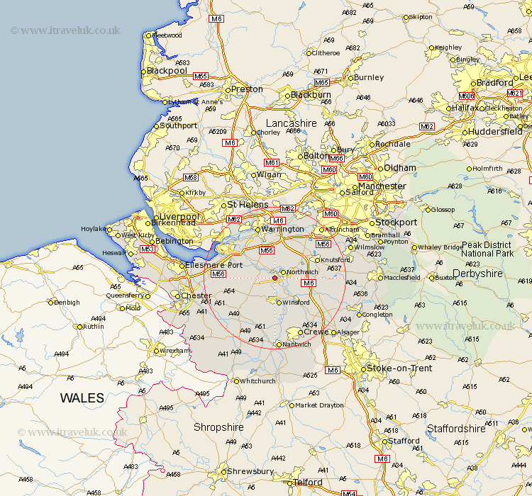
Cheshire Map Showing Location of Wallerscote
District: Vale Royal
Easting: 364418 Northing: 372717
Latitude: 53.25 Longitude: -2.53
 = Wallerscote
Easting: 364418 Northing: 372717
Latitude: 53.25 Longitude: -2.53
= Wallerscote
This Wallerscote map below is supplied by Google. Use the tools in the top left corner to zoom into street level or zoom out for a road map, you may also need to zoom in to see Wallerscote on the map. Click and drag the map to move around. If the map fails to load try and refresh your browser or zoom in or out (+ or -).
Update - it seems Google no longer allow people to use their maps for free! This Wallerscote map sometimes loads and sometimes gives a error. I am working on a solution.
Closest 30 Towns or Cities to Wallerscote (Population over 500)
Anderton 1.86km Hartford 2.16km Davenham 2.16km Marston 2.89km Northwich 2.89km Northwick 2.89km Weaverham 3.33km Whitegate 3.87km Acton 4.81km Lostock Gralam 4.81km Cuddington 4.81km Winsford 7.5km Plumbley 7.98km Plumley Station 7.98km Little Budworth 8.64km Kingsley 9.06km Stretton 9.52km Delamere 9.62km Middlewich 9.97km Middlewick 9.97km Kelsall 10.65km Kelshall Hill 10.65km Kelsall Hill 10.65km Preston Brook 10.73km Preston on the Hill 10.73km Preston-on-the-Hill 10.73km Appleton 11.17km Mere 12.08km Peover Superior 12.2km Peover 12.2km