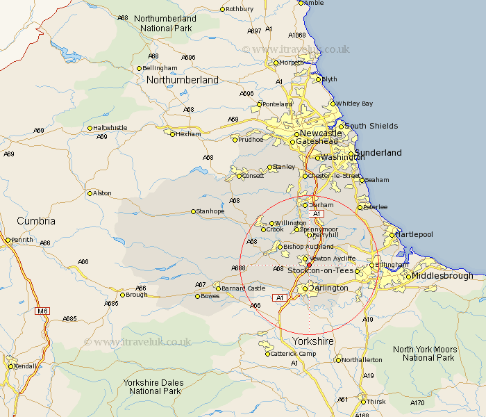
Durham Map Showing Location of Aycliffe
District: Sedgefield
Easting: 429068 Northing: 522864
Latitude: 54.6 Longitude: -1.55
 = Aycliffe
Easting: 429068 Northing: 522864
Latitude: 54.6 Longitude: -1.55
= Aycliffe
This Aycliffe map below is supplied by Google. Use the tools in the top left corner to zoom into street level or zoom out for a road map, you may also need to zoom in to see Aycliffe on the map. Click and drag the map to move around. If the map fails to load try and refresh your browser or zoom in or out (+ or -).
Update - it seems Google no longer allow people to use their maps for free! This Aycliffe map sometimes loads and sometimes gives a error. I am working on a solution.
Closest 30 Towns or Cities to Aycliffe (Population over 500)
Newton Aycliffe 2.14km Shildon 7.43km Darlington 7.49km Stillington 7.52km Ferryhill 9.27km Sedgefield 9.34km Bishop Auckland 9.34km Coundon 9.82km Carlton 9.84km Bishop Middleham 10.21km Grindon 10.89km West Cornforth 11.32km Cornforth 11.32km Spennymoor 11.5km Fishburn 11.92km West Auckland 12.37km Stockton on Tees 12.59km Stockton 12.59km Stockton-on-Tees 12.59km Gainford 13.06km Hurworth 13.15km Coxhoe 13.37km High Etherley 14.02km Etherley 14.02km Trimdon 14.04km Evenwood 14.08km Eaglescliffe 14.87km Bowburn 14.98km Egglescliffe 15.88km Billingham 16.1km