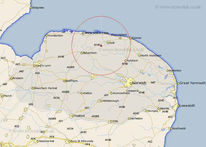
Norfolk Map Showing Location of Sharrington
District: North Norfolk
Easting: 602950 Northing: 336057
Latitude: 52.88 Longitude: 1.02
 = Sharrington
Easting: 602950 Northing: 336057
Latitude: 52.88 Longitude: 1.02
= Sharrington
This Sharrington map below is supplied by Google. Use the tools in the top left corner to zoom into street level or zoom out for a road map, you may also need to zoom in to see Sharrington on the map. Click and drag the map to move around. If the map fails to load try and refresh your browser or zoom in or out (+ or -).
Update - it seems Google no longer allow people to use their maps for free! This Sharrington map sometimes loads and sometimes gives a error. I am working on a solution.
Closest 30 Towns or Cities to Sharrington (Population over 500)
Melton Constable 3.87km Mellon Constable 3.87km Holt 4.84km Briston 5km Hindolveston 7.41km Little Snoring 8.66km Little Walsingham 8.95km Walsingham 8.95km Blakeney 9.34km Ryburgh 10km Great Ryburgh 10km Weybourne 10.53km Corpusty 10.78km Foulsham 11.12km Foulham 11.12km Sheringham 13.49km Fakenham 13.51km Sculthorpe 13.93km Wells 14.52km Wells-on-Sea 14.52km Wells next the Sea 14.52km Wells on Sea 14.52km Wells-next-the-Sea 14.52km Colkirk 14.53km Reepham 16.27km Cawston 16.42km Runton 16.61km West Runton 16.61km Erpingham 16.62km Bawdeswell 16.72km