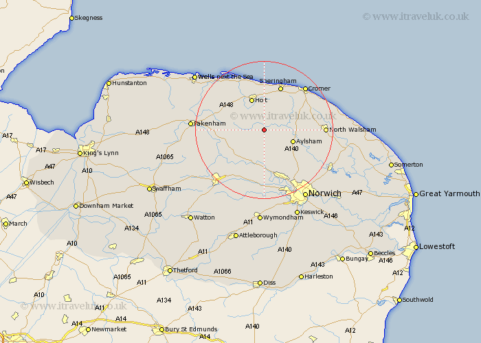
Norfolk Map Showing Location of Saxthorpe
District: North Norfolk
Easting: 611119 Northing: 328988
Latitude: 52.82 Longitude: 1.13
 = Saxthorpe
Easting: 611119 Northing: 328988
Latitude: 52.82 Longitude: 1.13
= Saxthorpe
This Saxthorpe map below is supplied by Google. Use the tools in the top left corner to zoom into street level or zoom out for a road map, you may also need to zoom in to see Saxthorpe on the map. Click and drag the map to move around. If the map fails to load try and refresh your browser or zoom in or out (+ or -).
Update - it seems Google no longer allow people to use their maps for free! This Saxthorpe map sometimes loads and sometimes gives a error. I am working on a solution.
Closest 30 Towns or Cities to Saxthorpe (Population over 500)
Briston 5.81km Cawston 5.99km Reepham 7.5km Mellon Constable 7.67km Melton Constable 7.67km Hindolveston 7.84km Erpingham 8.05km Foulham 8.68km Foulsham 8.68km Aylsham 8.68km Witchingham 9.34km Marsham 9.62km Holt 9.85km Bawdeswell 11.46km Hevingham 11.64km Lyng 11.99km Weybourne 13.01km Roughton 13.42km Felmingham 13.57km Sheringham 13.72km Ryburgh 14.56km Great Ryburgh 14.56km West Runton 15.15km Runton 15.15km Lamas Little Hautbois 15.36km Little Hautbois 15.36km Lammas 15.36km North Elmham 15.43km Hainford 15.79km Haynford 15.79km