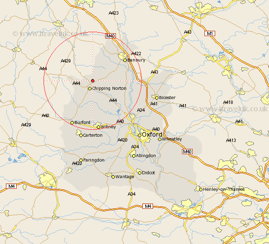
Oxfordshire Map Showing Location of Rollwright
District: West Oxfordshire
Easting: 433202 Northing: 229960
Latitude: 51.97 Longitude: -1.52
 = Rollwright
Easting: 433202 Northing: 229960
Latitude: 51.97 Longitude: -1.52
= Rollwright
This Rollwright map below is supplied by Google. Use the tools in the top left corner to zoom into street level or zoom out for a road map, you may also need to zoom in to see Rollwright on the map. Click and drag the map to move around. If the map fails to load try and refresh your browser or zoom in or out (+ or -).
Update - it seems Google no longer allow people to use their maps for free! This Rollwright map sometimes loads and sometimes gives a error. I am working on a solution.
Closest 30 Towns or Cities to Rollwright (Population over 500)
Hook Norton 2.94km Chipping Norton 3.53km Barton 7.09km Enstone 7.2km Churchill 8.71km Chadlington 9.27km Kingham 10.1km Barford Saint John 10.44km Barford St. John 10.44km Barford St John 10.44km Barford 10.44km Bloxham 10.92km Charlbury 11.64km Duns Tew 13.1km Wroxton 13.69km Shipton 13.76km Shipton under Wychwood 13.76km Shipton-under-Wychwood 13.76km Deddington 13.82km Adderbury 14.19km Banbury 15.6km Steeple Aston 15.86km Stonesfield 15.9km Leafield 16.72km Upper Heyford 17.53km Tackley 17.66km Minster Lovell 18.57km Hailey 18.68km Woodstock 18.88km North Leigh 19.4km