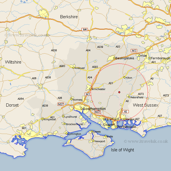
Hampshire Map Showing Location of Privett
District: East Hampshire
Easting: 467775 Northing: 126497
Latitude: 51.03 Longitude: -1.03
 = Privett
Easting: 467775 Northing: 126497
Latitude: 51.03 Longitude: -1.03
= Privett
This Privett map below is supplied by Google. Use the tools in the top left corner to zoom into street level or zoom out for a road map, you may also need to zoom in to see Privett on the map. Click and drag the map to move around. If the map fails to load try and refresh your browser or zoom in or out (+ or -).
Update - it seems Google no longer allow people to use their maps for free! This Privett map sometimes loads and sometimes gives a error. I am working on a solution.
Closest 30 Towns or Cities to Privett (Population over 500)
Froxfield 2.97km West Meon 3.95km Ropley 5.1km East Meon 5.56km Bramdean 5.83km Steep 7.23km Petersfield 7.91km Upper Farringdon 8.2km Faringdon 8.2km Farringdon 8.2km Selborne 8.93km Liss 9.32km Four Marks 9.35km Buriton 9.43km Greatham 9.5km Cheriton 9.51km Medstead 9.56km Corhampton 10.19km New Alresford 10.85km Clanfield 11.36km Droxford 11.61km Alton 11.65km Soberton 13.14km Hambledon 13.17km Horndean 13.43km Swanmore 14.52km Kingsley 14.89km Bordon 15.81km Bordon Camp 15.81km Bishop's Waltham 15.83km