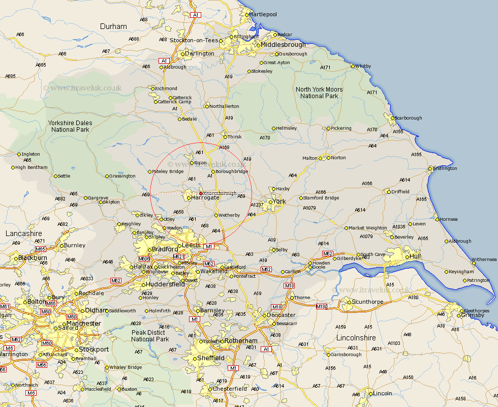
Yorkshire Map Showing Location of Knaresborough
Population: 13160
Area Size (ha): 331
District: Harrogate
Easting: 434956 Northing: 456149
Latitude: 54 Longitude: -1.47
 = Knaresborough
Area Size (ha): 331
District: Harrogate
Easting: 434956 Northing: 456149
Latitude: 54 Longitude: -1.47
= Knaresborough
This Knaresborough map below is supplied by Google. Use the tools in the top left corner to zoom into street level or zoom out for a road map, you may also need to zoom in to see Knaresborough on the map. Click and drag the map to move around. If the map fails to load try and refresh your browser or zoom in or out (+ or -).
Update - it seems Google no longer allow people to use their maps for free! This Knaresborough map sometimes loads and sometimes gives a error. I am working on a solution.
Closest 30 Towns or Cities to Knaresborough (Population over 500)
Knaresborough 0km Harrogate 4.74km Killinghall 5.75km Pannal 7.07km Burton Leonard 7.73km Hampsthwaite 8.91km Bishop Monkton 9.51km Monkton 9.51km Marton 9.88km Marton le Moor 9.88km Whixley 9.98km Boroughbridge 10.23km Birstwith 10.48km Wetherby 10.75km Green Hammerton 10.89km Kirk Hammerton 11.05km Hammerton 11.05km Great Ouseburn 11.27km Ouseburn 11.27km Harewood 11.33km Weeton 11.34km Collingham 11.94km Thorpe Arch 12.72km Thorp Arch 12.72km Bardsey 13.16km East Keswick 13.3km Ripon 13.38km Boston Spa 13.49km Arthington 14.13km Arthington Junction Station 14.13km