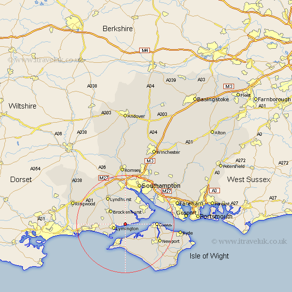
Hampshire Map Showing Location of Norleywood
District: New Forest
Easting: 436432 Northing: 96536
Latitude: 50.77 Longitude: -1.48
 = Norleywood
Easting: 436432 Northing: 96536
Latitude: 50.77 Longitude: -1.48
= Norleywood
This Norleywood map below is supplied by Google. Use the tools in the top left corner to zoom into street level or zoom out for a road map, you may also need to zoom in to see Norleywood on the map. Click and drag the map to move around. If the map fails to load try and refresh your browser or zoom in or out (+ or -).
Update - it seems Google no longer allow people to use their maps for free! This Norleywood map sometimes loads and sometimes gives a error. I am working on a solution.
Closest 30 Towns or Cities to Norleywood (Population over 500)
Boldre 3.52km Lymington 5.04km Beaulieu 6.03km Bewley 6.03km Yarmouth 7.51km Brockenhurst 8.08km Sway 8.41km Hordle 8.41km Milford-on-Sea 8.99km Milford 8.99km Milford on Sea 8.99km Shalfleet 9.46km Fawley 10.9km Freshwater 11.36km Dibden 11.66km Totland 11.66km Gurnard 11.87km Northwood 12.3km Milton 12.3km New Milton 12.3km Hythe 12.57km Calbourne 12.57km Cowes 12.89km East Cowes 13.03km Lyndhurst 13.15km Marchwood 13.44km Barton-on-Sea 14.05km Barton 14.05km Barton on Sea 14.05km Eling 14.82km