Hampshire Map Showing Location of Newbridge
Easting: 441205 Northing: 87298
Latitude: 50.68 Longitude: -1.42
 = Newbridge
Latitude: 50.68 Longitude: -1.42
= Newbridge
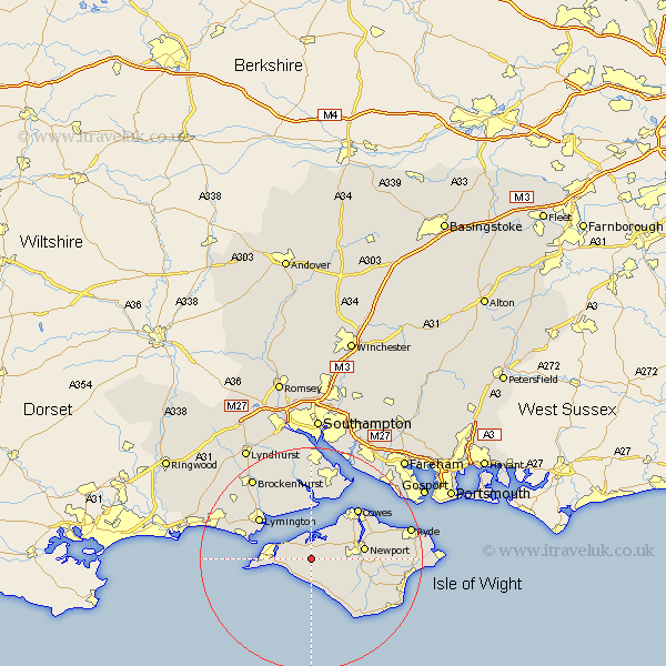
This Newbridge map below is supplied by Google. Use the tools in the top left corner to zoom into street level or zoom out for a road map, you may also need to zoom in to see Newbridge on the map. Click and drag the map to move around. If the map fails to load try and refresh your browser or zoom in or out (+ or -).
Update - it seems Google no longer allow people to use their maps for free! This Newbridge map sometimes loads and sometimes gives a error. I am working on a solution.
Closest 30 Towns or Cities to Newbridge (Population over 500)
Calbourne 2.19km Shalfleet 2.2km Brightstone 6.04km Brighstone 6.04km Yarmouth 6.16km Shorwell 7.28km Freshwater 7.28km Totland 8.43km Northwood 8.97km Newport 9.57km Rookley 10.1km Gurnard 10.23km East Cowes 11.07km Arreton 11.89km Lymington 11.96km Boldre 12.39km Cowes 12.39km Chale 13.17km Milford 13.24km Milford on Sea 13.24km Milford-on-Sea 13.24km Wootton 13.44km Godshill 13.89km Niton 14.56km Hordle 14.89km Bewley 15.02km Beaulieu 15.02km Newchurch 15.38km Fawley 15.56km Wroxall 16.87km