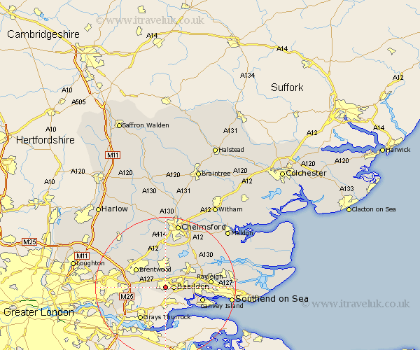
Essex Map Showing Location of Laindon
District: Basildon
Easting: 568629 Northing: 188172
Latitude: 51.57 Longitude: 0.43
 = Laindon
Easting: 568629 Northing: 188172
Latitude: 51.57 Longitude: 0.43
= Laindon
This Laindon map below is supplied by Google. Use the tools in the top left corner to zoom into street level or zoom out for a road map, you may also need to zoom in to see Laindon on the map. Click and drag the map to move around. If the map fails to load try and refresh your browser or zoom in or out (+ or -).
Update - it seems Google no longer allow people to use their maps for free! This Laindon map sometimes loads and sometimes gives a error. I am working on a solution.
Closest 30 Towns or Cities to Laindon (Population over 500)
Great Burstead 2.17km Basildon 2.3km Corringham 5.35km Ramsden Heath 5.67km Billericay 5.68km Wickford 6.85km Herongate 6.86km Ingrave 7.15km Stanford le Hope 7.51km Benfleet 8.88km South Benfleet 8.88km Stock 9.26km Mountnessing 9.38km South Hanningfield 9.38km Brentwood 9.79km Rawreth 9.93km West Hanningfield 10.34km Canvey Island 11.02km Grays Thurrock 11.57km Grays 11.57km Ingatestone 11.64km South Ockedon 11.83km South Ockendon 11.83km Rettendon 12.28km Rayleigh 12.8km Margaretting 13.02km East Hanningfield 13.73km Tilbury 13.77km Tilbury Fort 13.77km Woodham Ferrers 14.77km