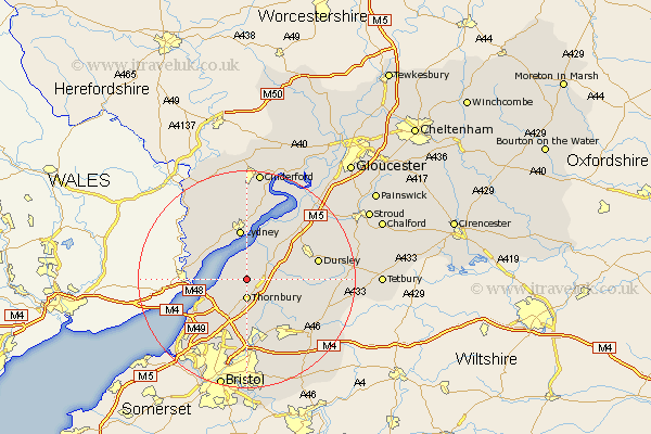
Gloucestershire Map Showing Location of Morton
Easting: 364244 Northing: 192899
Latitude: 51.63 Longitude: -2.52
 = Morton
Latitude: 51.63 Longitude: -2.52
= Morton
This Morton map below is supplied by Google. Use the tools in the top left corner to zoom into street level or zoom out for a road map, you may also need to zoom in to see Morton on the map. Click and drag the map to move around. If the map fails to load try and refresh your browser or zoom in or out (+ or -).
Update - it seems Google no longer allow people to use their maps for free! This Morton map sometimes loads and sometimes gives a error. I am working on a solution.
Closest 30 Towns or Cities to Morton (Population over 500)
Thornbury 3.7km Alveston 3.88km Stone 3.92km Tytherington 4.36km Falfield 4.6km Cromhall 4.96km Olveston 6.55km Charfield 7.15km Berkeley 7.22km Aust 7.83km Rangeworthy 8.72km Lydney 9.34km Woolaston 9.38km Tidenham 9.39km Iron Acton 9.89km Almondsbury 9.89km North Nibley 9.92km Wickwar 10.75km Winterbourne 11.04km Frampton Cotterell 11.36km Wotton-under-Edge 11.5km Wotton under Edge 11.5km Patchway 11.64km Pilning 12.28km Slimbridge 13.06km Stoke Gifford 13.17km Dursley 13.18km Filton 13.42km Bream 13.43km Cam 13.68km