Berkshire Map Showing Location of Mortimer Common
Easting: 464966 Northing: 163539
Latitude: 51.37 Longitude: -1.07
 = Mortimer Common
Latitude: 51.37 Longitude: -1.07
= Mortimer Common
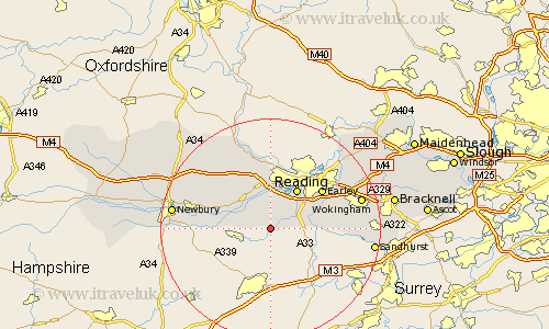
This Mortimer Common map below is supplied by Google. Use the tools in the top left corner to zoom into street level or zoom out for a road map, you may also need to zoom in to see Mortimer Common on the map. Click and drag the map to move around. If the map fails to load try and refresh your browser or zoom in or out (+ or -).
Update - it seems Google no longer allow people to use their maps for free! This Mortimer Common map sometimes loads and sometimes gives a error. I am working on a solution.
Closest 30 Towns or Cities to Mortimer Common (Population over 500)
Mortimer 3.47km Stratfield Mortimer 3.47km Burghfield 4.37km Aldermaston 6.07km Theale 7.41km Beenham 8.02km Brimpton 8.1km Swallowfield 8.1km Bradfield 8.73km Reading 8.73km Shinfield 8.9km Tilehurst 9.55km Arborfield 11.05km Aberfield 11.05km Bucklebury 11.85km Earley 11.85km Barkham 12.86km Pangbourne 13.02km Cold Ash 13.88km Thatcham 14.36km Winnersh 14.95km Greenham 15.15km Finchampstead 15.16km Basildon 15.22km Woodley 15.73km Sonning 16.04km Shaw 16.61km Hermitage 16.68km Wokingham 17.12km Crowthorne 17.36km