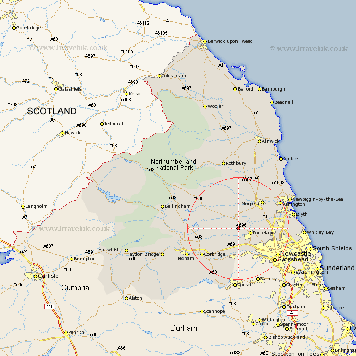
Northumberland Map Showing Location of Milbourne
District: Castle Morpeth
Easting: 411706 Northing: 574714
Latitude: 55.07 Longitude: -1.82
 = Milbourne
Easting: 411706 Northing: 574714
Latitude: 55.07 Longitude: -1.82
= Milbourne
This Milbourne map below is supplied by Google. Use the tools in the top left corner to zoom into street level or zoom out for a road map, you may also need to zoom in to see Milbourne on the map. Click and drag the map to move around. If the map fails to load try and refresh your browser or zoom in or out (+ or -).
Update - it seems Google no longer allow people to use their maps for free! This Milbourne map sometimes loads and sometimes gives a error. I am working on a solution.
Closest 30 Towns or Cities to Milbourne (Population over 500)
Ponteland 4.63km Stamfordham 4.89km Dinnington 8.69km Woolsington 10.15km Stannington 10.24km Wylam 11.32km Ovingham 11.57km Newburn 12.32km Prudhoe 13.15km Morpeth 13.98km Hepscott 14.08km Dudley 14.31km Gosforth 14.75km Cramlington 14.86km Hebron 15.49km Pegswood 16.11km Stocksfield 16.15km Killingworth 16.35km Bedlington 16.42km Shiremoor 16.5km Corbridge 16.92km Seghill 17.08km Sandhoe 17.53km Long Benton 17.57km Longbenton 17.57km Ridingmill 17.65km Riding 17.65km Newcastle-on-Tyne 17.74km Newcastle 17.74km Newcastle on Tyne 17.74km