Durham Map Showing Location of Middleton One Row
Easting: 434535 Northing: 511776
Latitude: 54.5 Longitude: -1.47
 = Middleton One Row
Latitude: 54.5 Longitude: -1.47
= Middleton One Row
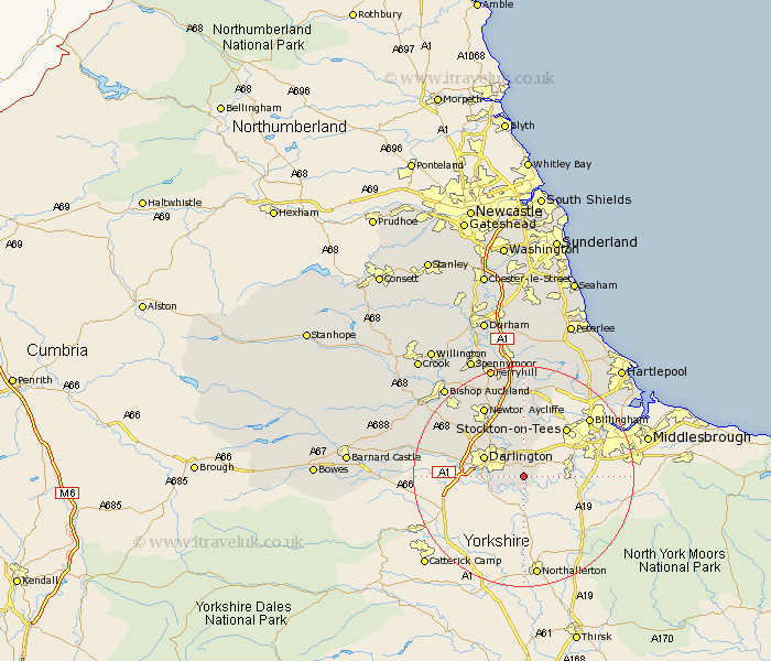
This Middleton One Row map below is supplied by Google. Use the tools in the top left corner to zoom into street level or zoom out for a road map, you may also need to zoom in to see Middleton One Row on the map. Click and drag the map to move around. If the map fails to load try and refresh your browser or zoom in or out (+ or -).
Update - it seems Google no longer allow people to use their maps for free! This Middleton One Row map sometimes loads and sometimes gives a error. I am working on a solution.
Closest 30 Towns or Cities to Middleton One Row (Population over 500)
Hurworth 3.73km Darlington 7.44km Yarm-on-Tees 7.53km Yarm 7.53km Yarm on Tees 7.53km Egglescliffe 7.76km Eaglescliffe 8.39km Carlton 10.21km Stillington 11.32km Thornaby-on-Tees 11.38km Thornaby 11.38km Thornaby on Tees 11.38km Stockton on Tees 11.67km Stockton 11.67km Stockton-on-Tees 11.67km Grindon 14.05km Newton Aycliffe 14.49km Billingham-on-Tees 15.47km Billingham 15.47km Billingham on Tees 15.47km Sedgefield 16.82km Wolviston 17.55km Gainford 18.08km Shildon 18.96km Bishop Middleham 20.41km Fishburn 20.49km Bishop Auckland 21.08km Ferryhill 21.08km Greatham 21.12km Coundon 21.98km