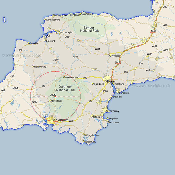
Devon Map Showing Location of Marytavy
District: West Devon
Easting: 251348 Northing: 78122
Latitude: 50.58 Longitude: -4.1
 = Marytavy
Easting: 251348 Northing: 78122
Latitude: 50.58 Longitude: -4.1
= Marytavy
This Marytavy map below is supplied by Google. Use the tools in the top left corner to zoom into street level or zoom out for a road map, you may also need to zoom in to see Marytavy on the map. Click and drag the map to move around. If the map fails to load try and refresh your browser or zoom in or out (+ or -).
Update - it seems Google no longer allow people to use their maps for free! This Marytavy map sometimes loads and sometimes gives a error. I am working on a solution.
Closest 30 Towns or Cities to Marytavy (Population over 500)
Tavistock 5.12km Whitechurch 6.04km Whitchurch 6.04km Lamerton 6.17km Walkhampton 7.77km Horrabridge 9.26km Buckland Monachorum 9.56km Gunnislake 9.94km Milton Abbot 10.75km Bridestowe 11.12km Yelverton 11.18km Meavy 11.67km Dartmoor Forest 12.94km Lifton 14.08km Bickleigh 15.01km Shaugh Prior 15.24km Broadwoodwidger 15.35km Okehampton 18.11km St Giles-on-the-Heath 19.86km St. Giles-on-the-Heath 19.86km Saint Giles 19.86km St. Giles on the Heath 19.86km St Giles 19.86km St. Giles 19.86km St Giles on the Heath 19.86km Saint Giles on the Heath 19.86km Saint Giles-on-the-Heath 19.86km Plymouth 20.42km Northlew 20.43km Cornwood 20.79km