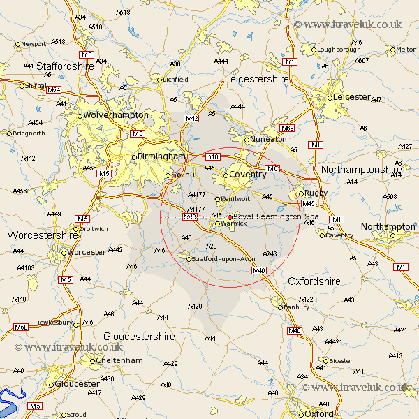
Warwickshire Map Showing Location of Royal Leamington Spa
Population: 55133
Area Size (ha): 1348
District: Warwick
Easting: 431819 Northing: 267021
Latitude: 52.3 Longitude: -1.53
 = Royal Leamington Spa
Area Size (ha): 1348
District: Warwick
Easting: 431819 Northing: 267021
Latitude: 52.3 Longitude: -1.53
= Royal Leamington Spa
This Royal Leamington Spa map below is supplied by Google. Use the tools in the top left corner to zoom into street level or zoom out for a road map, you may also need to zoom in to see Royal Leamington Spa on the map. Click and drag the map to move around. If the map fails to load try and refresh your browser or zoom in or out (+ or -).
Update - it seems Google no longer allow people to use their maps for free! This Royal Leamington Spa map sometimes loads and sometimes gives a error. I am working on a solution.
Closest 30 Towns or Cities to Royal Leamington Spa (Population over 500)
Warwick 3.88km Stoneleigh 5.67km Whitnash 5.67km Bubbenhall 5.85km Kenilworth 6.52km Bishops Tachbrook 7.42km Hatton 7.93km Baginton 8.16km Barford 8.69km Shrewley 9.07km Harbury 9.34km Long Itchington 10.85km Rowington 11.48km Southam 11.62km Brandon 11.71km Claverdon 11.93km Wolston 12.6km Temple Balsall 12.61km Stockton 13.01km Coventry 13.03km Allesley 13.03km Berkeswell 13.03km Berkswell 13.03km Bishops Itchington 13.04km Lighthorne 13.17km Wellesbourne 13.42km Wellesbourne Hastings 13.42km Keresley 14.82km Lapworth 15.19km Bearley 15.5km