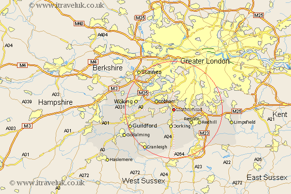
Surrey Map Showing Location of Leatherhead
Population: 41974
Area Size (ha): 1651
District: Mole Valley
Easting: 517383 Northing: 155197
Latitude: 51.28 Longitude: -0.32
 = Leatherhead
Area Size (ha): 1651
District: Mole Valley
Easting: 517383 Northing: 155197
Latitude: 51.28 Longitude: -0.32
= Leatherhead
This Leatherhead map below is supplied by Google. Use the tools in the top left corner to zoom into street level or zoom out for a road map, you may also need to zoom in to see Leatherhead on the map. Click and drag the map to move around. If the map fails to load try and refresh your browser or zoom in or out (+ or -).
Update - it seems Google no longer allow people to use their maps for free! This Leatherhead map sometimes loads and sometimes gives a error. I am working on a solution.
Closest 30 Towns or Cities to Leatherhead (Population over 500)
Leatherhead 0km Mickleham 3.7km Oxshott 4.38km Tadworth 5.8km Effingham 6.88km Buckland 7.24km Betchworth 7.24km Dorking 7.5km Westcott 7.76km Claygate 7.77km Cobham 7.88km Church Cobham 7.88km Esher 8.19km Reigate 8.91km East Horsley 8.92km Horsley 8.92km West Horsley 9.46km Wotton 10.36km Leigh 10.93km Banstead 11.07km Holmwood 11.12km Ripley 11.59km Byfleet 11.82km Redhill 11.83km Abinger 12.54km Molesey 13.18km West Clandon 13.28km Walton 13.76km Walton upon Thames 13.76km Weybridge 13.95km