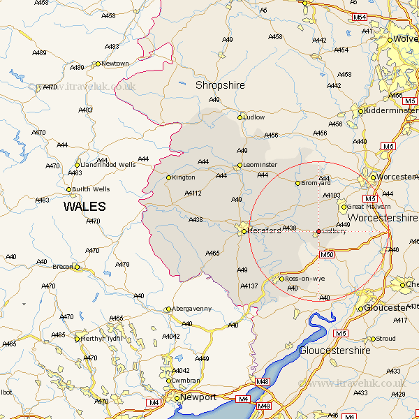
Herefordshire Map Showing Location of Ledbury
Population: 6093
Area Size (ha): 186
Easting: 371430 Northing: 239196
Latitude: 52.05 Longitude: -2.42
 = Ledbury
Area Size (ha): 186
Easting: 371430 Northing: 239196
Latitude: 52.05 Longitude: -2.42
= Ledbury
This Ledbury map below is supplied by Google. Use the tools in the top left corner to zoom into street level or zoom out for a road map, you may also need to zoom in to see Ledbury on the map. Click and drag the map to move around. If the map fails to load try and refresh your browser or zoom in or out (+ or -).
Update - it seems Google no longer allow people to use their maps for free! This Ledbury map sometimes loads and sometimes gives a error. I am working on a solution.
Closest 30 Towns or Cities to Ledbury (Population over 500)
Colwall 4.35km Bosbury 4.35km Cradley 6.62km Much Marcle 7.96km Upton Bishop 13.06km Fownhope 13.72km Mordiford 14.82km Withington 15.82km Bromyard 15.88km Lugwardine 16.06km Weston-under-Penyard 16.84km Weston under Penyard 16.84km Weston 16.84km Lea 17.63km Ross on Wye 18.03km Ross 18.03km Ross-on-wye 18.03km Whitbourne 18.57km Sutton 19.05km Hereford 20.51km Bullingham 20.6km Bodenham 21.34km Moreton-on-Lugg 22.35km Moreton on Lugg 22.35km Moreton 22.35km Walford 22.39km Much Birch 22.53km Much Dewchurch 23.99km Burghill 24.56km Goodrich 24.56km