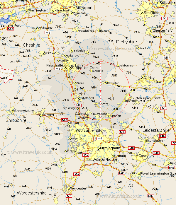
Staffordshire Map Showing Location of Kingston
District: East Staffordshire
Easting: 406733 Northing: 328096
Latitude: 52.85 Longitude: -1.9
 = Kingston
Easting: 406733 Northing: 328096
Latitude: 52.85 Longitude: -1.9
= Kingston
This Kingston map below is supplied by Google. Use the tools in the top left corner to zoom into street level or zoom out for a road map, you may also need to zoom in to see Kingston on the map. Click and drag the map to move around. If the map fails to load try and refresh your browser or zoom in or out (+ or -).
Update - it seems Google no longer allow people to use their maps for free! This Kingston map sometimes loads and sometimes gives a error. I am working on a solution.
Closest 30 Towns or Cities to Kingston (Population over 500)
Abbots Bromley 3.87km Uttoxeter 6.49km Marchington 6.97km Weston 8.05km Weston upon Trent 8.05km Leigh 8.66km Church Leigh 8.66km Colwich 9.29km Colton 9.33km Rugeley 9.53km Checkley 9.85km Hanbury 11.35km Rocester 11.98km Alton 13.02km Armitage 13.03km Denston 13.4km Denstone 13.4km Hopton 13.56km Yoxall 13.61km Hatton 14.23km Hilderstone 14.36km Bednall 14.54km Stafford 14.54km Tutbury 14.55km Longdon 14.86km Anslow 15.02km Tatenhill 15.35km Draycott in the Moors 15.76km Draycott 15.76km Fulford 15.77km