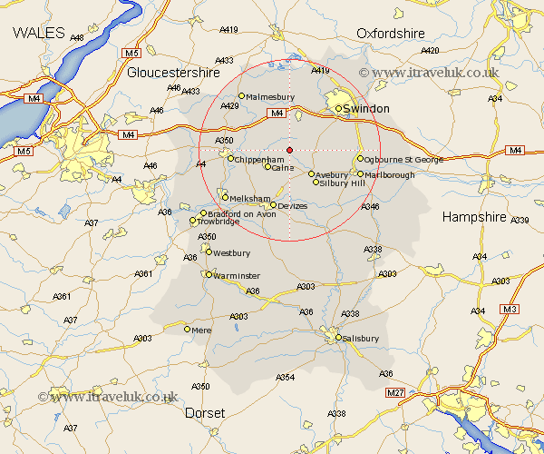
Wiltshire Map Showing Location of Highway
District: North Wiltshire
Easting: 404630 Northing: 174248
Latitude: 51.47 Longitude: -1.93
 = Highway
Easting: 404630 Northing: 174248
Latitude: 51.47 Longitude: -1.93
= Highway
This Highway map below is supplied by Google. Use the tools in the top left corner to zoom into street level or zoom out for a road map, you may also need to zoom in to see Highway on the map. Click and drag the map to move around. If the map fails to load try and refresh your browser or zoom in or out (+ or -).
Update - it seems Google no longer allow people to use their maps for free! This Highway map sometimes loads and sometimes gives a error. I am working on a solution.
Closest 30 Towns or Cities to Highway (Population over 500)
Hilmarton 2.31km Hillmarton 2.31km Broad Town 4.97km Cherhill 5.68km Calne 5.93km Lyneham 6.02km Broad Hinton 7.17km Bremhill 7.17km Wooton Bassett 7.76km Wootton Bassett 7.76km Christian Malford 8.89km Brinkworth 9.89km Sutton Benger 11.03km Bishops Cannings 11.18km Roundway 11.65km Wroughton 11.78km Great Somerford 11.83km Somerford 11.83km Lydiard Millicent 12.04km Chippenham 12.84km Devizes 13.43km Purton 13.76km Swindon 14.42km Lea 14.45km Rowde 14.71km Lacock 14.72km Laycock 14.72km Stanton Saint Quintin 14.92km Stanton St. Quintin 14.92km Stanton 14.92km