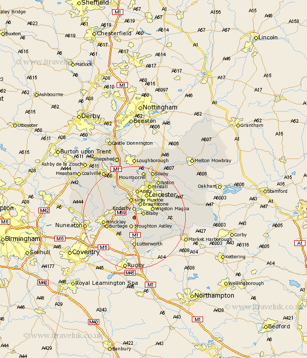
Leicestershire Map Showing Location of Hethel
District: Blaby
Easting: 454239 Northing: 295024
Latitude: 52.55 Longitude: -1.2
 = Hethel
Easting: 454239 Northing: 295024
Latitude: 52.55 Longitude: -1.2
= Hethel
This Hethel map below is supplied by Google. Use the tools in the top left corner to zoom into street level or zoom out for a road map, you may also need to zoom in to see Hethel on the map. Click and drag the map to move around. If the map fails to load try and refresh your browser or zoom in or out (+ or -).
Update - it seems Google no longer allow people to use their maps for free! This Hethel map sometimes loads and sometimes gives a error. I am working on a solution.
Closest 30 Towns or Cities to Hethel (Population over 500)
Cosby 1.13km Narborough 1.85km Whetstone 2.17km Croft 2.25km Enderby 3.7km Blaby 3.86km Broughton Astley 3.87km Countesthorpe 4.51km Stoney Stanton 4.88km Sapcote 5.84km Glen Parka 5.93km Glen Parva 5.93km Braunstone 6km Sharnford 6.74km Elmsthorpe 6.76km Elmesthorpe 6.76km Kirby Muxloe 7.5km Wigston 7.71km Wigston Magna 7.71km Little Claybrooke 8.68km Claybrooke Parva 8.68km Claybrooke 8.68km Oadby 8.71km Desford 9.31km Ullesthorpe 9.86km Gilmorton 9.86km Gilmarton 9.86km Leiscester 10.3km Leicester 10.3km Burbage 10.8km