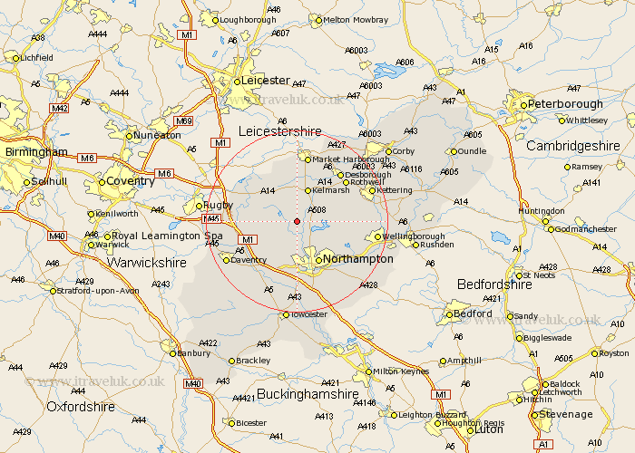
Northamptonshire Map Showing Location of Great Creaton
District: Daventry
Easting: 471538 Northing: 271141
Latitude: 52.33 Longitude: -0.95
 = Great Creaton
Easting: 471538 Northing: 271141
Latitude: 52.33 Longitude: -0.95
= Great Creaton
This Great Creaton map below is supplied by Google. Use the tools in the top left corner to zoom into street level or zoom out for a road map, you may also need to zoom in to see Great Creaton on the map. Click and drag the map to move around. If the map fails to load try and refresh your browser or zoom in or out (+ or -).
Update - it seems Google no longer allow people to use their maps for free! This Great Creaton map sometimes loads and sometimes gives a error. I am working on a solution.
Closest 30 Towns or Cities to Great Creaton (Population over 500)
Spratton 1.85km Guilsborough 3.4km Brixworth 3.87km Pitsford 5.85km East Haddon 5.85km Naseby 6km Boughton 6.52km West Haddon 7.93km Long Buckby 8.75km Moulton 8.78km Walgrave 9.06km Clipston 9.27km Northampton 10.31km Overstone 10.63km Harpole 11.35km Welford 11.49km Yelvertoft 11.91km Crick 12.46km Sywell 12.62km Great Billing 12.96km Billing 12.96km Broughton 12.99km Kislingbury 13.02km Flore 13.03km Rothwell 13.77km Rowell 13.77km Desborough 14.34km Welton 14.69km Kilsby 14.72km Great Houghton 15.2km