Durham Map Showing Location of Frosterley
District: Wear Valley
Easting: 404292 Northing: 537604
Latitude: 54.73 Longitude: -1.93
 = Frosterley
Easting: 404292 Northing: 537604
Latitude: 54.73 Longitude: -1.93
= Frosterley
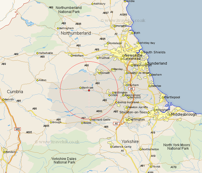
This Frosterley map below is supplied by Google. Use the tools in the top left corner to zoom into street level or zoom out for a road map, you may also need to zoom in to see Frosterley on the map. Click and drag the map to move around. If the map fails to load try and refresh your browser or zoom in or out (+ or -).
Update - it seems Google no longer allow people to use their maps for free! This Frosterley map sometimes loads and sometimes gives a error. I am working on a solution.
Closest 30 Towns or Cities to Frosterley (Population over 500)
Wolsingham 3.7km Stanhope 5.66km Tow Law 7.49km Castleside 11.91km Cornsay 12.05km Crook 13.37km Consett 14.47km Consetti 14.47km Etherley 14.99km High Etherley 14.99km Willington 15.1km Cockfield 15.54km Lanchester 15.83km Esh 15.97km Middleton in Teesdale 16.16km Evenwood 16.82km West Auckland 17km Leadgate 17.12km Annfield Plain 18.24km Langley Park 18.65km Cotherstone 18.8km Ushaw Moor 19.01km Bishop Auckland 19.48km Coundon 19.65km Brandon 20.41km Staindrop 20.41km Witton Gilbert 20.62km Stanley 21.21km Shildon 21.34km Spennymoor 21.74km