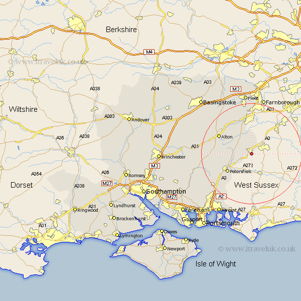
Hampshire Map Showing Location of Liphook
Population: 5221
Area Size (ha): 190
District: East Hampshire
Easting: 484073 Northing: 130451
Latitude: 51.07 Longitude: -0.8
 = Liphook
Area Size (ha): 190
District: East Hampshire
Easting: 484073 Northing: 130451
Latitude: 51.07 Longitude: -0.8
= Liphook
This Liphook map below is supplied by Google. Use the tools in the top left corner to zoom into street level or zoom out for a road map, you may also need to zoom in to see Liphook on the map. Click and drag the map to move around. If the map fails to load try and refresh your browser or zoom in or out (+ or -).
Update - it seems Google no longer allow people to use their maps for free! This Liphook map sometimes loads and sometimes gives a error. I am working on a solution.
Closest 30 Towns or Cities to Liphook (Population over 500)
Bramshot 1.85km Headley 5.68km Bordon Camp 6.57km Bordon 6.57km Greatham 7.23km Kingsley 7.25km Liss 7.92km Selborne 9.5km Steep 10.85km Binsted 10.94km Petersfield 11.91km Upper Farringdon 13.33km Faringdon 13.33km Farringdon 13.33km Bentley 13.77km Froyle 13.78km Alton 14.79km Froxfield 15.05km Buriton 15.29km Crondall 17.04km Four Marks 18.32km East Meon 18.77km Long Sutton 19.1km Medstead 19.44km Ropley 19.8km Clanfield 20.39km Aldershot 20.51km West Meon 20.57km Horndean 21.04km Upton Grey 21.75km