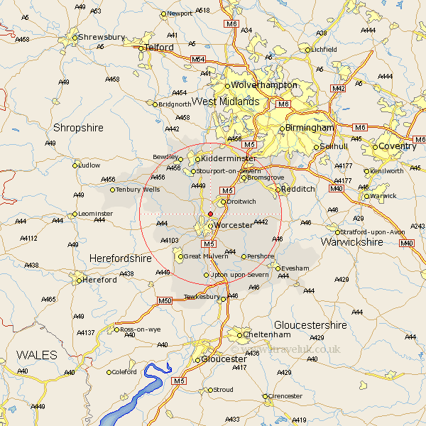
Worcestershire Map Showing Location of Fernhill Heath
Population: 2797
Area Size (ha): 72
District: Wychavon
Easting: 386342 Northing: 259519
Latitude: 52.23 Longitude: -2.2
 = Fernhill Heath
Area Size (ha): 72
District: Wychavon
Easting: 386342 Northing: 259519
Latitude: 52.23 Longitude: -2.2
= Fernhill Heath
This Fernhill Heath map below is supplied by Google. Use the tools in the top left corner to zoom into street level or zoom out for a road map, you may also need to zoom in to see Fernhill Heath on the map. Click and drag the map to move around. If the map fails to load try and refresh your browser or zoom in or out (+ or -).
Update - it seems Google no longer allow people to use their maps for free! This Fernhill Heath map sometimes loads and sometimes gives a error. I am working on a solution.
Closest 30 Towns or Cities to Fernhill Heath (Population over 500)
Fernhill Heath 0km Grimley 3.4km Worcester 3.7km Hallow 3.87km Holt 3.88km Ombersley 4.35km Droitwich 5.04km Crowle 6.78km Powick 8.15km Leigh 9.7km Astley 10.86km Hanbury 10.87km Kempsey 11.12km Hartlebury 11.35km Martley 11.35km Peopleton 11.5km Great Witley 11.62km Stoke Prior 11.72km Chaddesley Corbett 13.17km Wadborough 13.41km Abberley 13.55km Stourport-on-Severn 13.75km Stourport 13.75km Stourport on Severn 13.75km Bromsgrove 14.35km Bishampton 14.52km Great Dodford 14.65km Dodford 14.65km Stone 14.83km Seven Stoke 14.87km