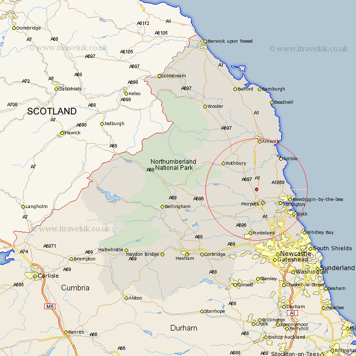
Northumberland Map Showing Location of Fenrother
District: Castle Morpeth
Easting: 418024 Northing: 591426
Latitude: 55.22 Longitude: -1.72
 = Fenrother
Easting: 418024 Northing: 591426
Latitude: 55.22 Longitude: -1.72
= Fenrother
This Fenrother map below is supplied by Google. Use the tools in the top left corner to zoom into street level or zoom out for a road map, you may also need to zoom in to see Fenrother on the map. Click and drag the map to move around. If the map fails to load try and refresh your browser or zoom in or out (+ or -).
Update - it seems Google no longer allow people to use their maps for free! This Fenrother map sometimes loads and sometimes gives a error. I am working on a solution.
Closest 30 Towns or Cities to Fenrother (Population over 500)
Longhorsley 3.67km Hebron 4.27km Morpeth 5.95km Felton 7.48km Pegswood 7.67km East Thirston 7.7km Thirston 7.7km Longframlington 8.53km Hepscott 8.54km Swarland 9.32km Ellington 9.52km Ashington 10.14km Lynemouth 11.06km East Chevington 11.24km Newbiggin by the Sea 12.45km Newbiggin-by-the-Sea 12.45km Bedlington 12.53km Stannington 13.36km Amble 15.47km Rothbury 16.08km Warkworth 16.12km Blyth 16.72km Blythe 16.72km Shilbottle 16.81km Dudley 17.35km Ponteland 18.66km Dinnington 18.66km Cramlington 18.71km Lesbury 19.58km Lisburg 19.58km