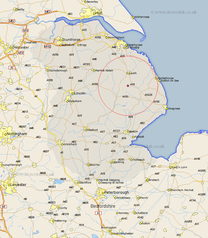
Lincolnshire Map Showing Location of Farforth
District: East Lindsey
Easting: 532209 Northing: 378123
Latitude: 53.28 Longitude: -0.02
 = Farforth
Easting: 532209 Northing: 378123
Latitude: 53.28 Longitude: -0.02
= Farforth
This Farforth map below is supplied by Google. Use the tools in the top left corner to zoom into street level or zoom out for a road map, you may also need to zoom in to see Farforth on the map. Click and drag the map to move around. If the map fails to load try and refresh your browser or zoom in or out (+ or -).
Update - it seems Google no longer allow people to use their maps for free! This Farforth map sometimes loads and sometimes gives a error. I am working on a solution.
Closest 30 Towns or Cities to Farforth (Population over 500)
Legbourne 7.11km Louth 9.27km Banovallum 11.41km Horncastle 11.41km Grimoldby 11.41km Mareham-on-the-Hill 11.61km Mareham 11.61km Mareham on the Hill 11.61km Manby 12.08km Spilsby 13.56km Alford 13.81km Willoughby 16.21km Fulstow 18.54km Saltfleetby St Clement 18.57km Saltfleetby Saint Clement 18.57km Saltfleetby 18.57km Saltfleetby St. Clement 18.57km Mablethorpe 18.57km Wragby 18.84km Huttoft 19.2km Saltfleet 19.91km Woodhall Spa 19.93km binbrook 20.01km North Somercotes 20.01km Sutton on Sea 20.28km Sutton-on-Sea 20.28km North Thoresby 20.51km North Coates 20.66km Coningsby 21.05km Holton 21.13km