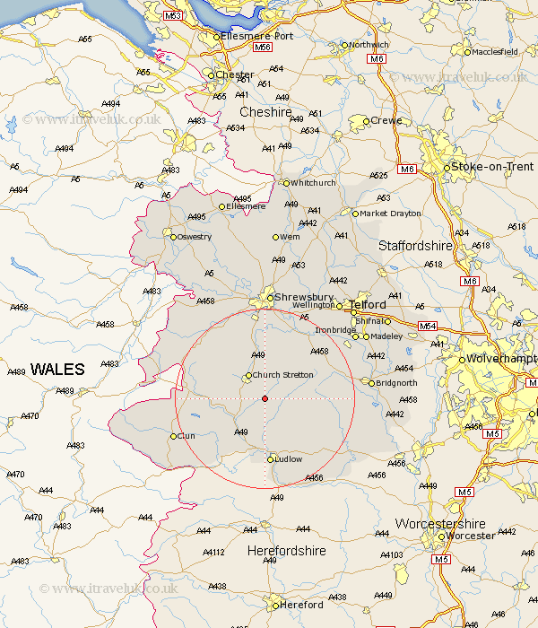
Shropshire Map Showing Location of Eaton
District: South Shropshire
Easting: 349092 Northing: 289427
Latitude: 52.5 Longitude: -2.75
 = Eaton
Easting: 349092 Northing: 289427
Latitude: 52.5 Longitude: -2.75
= Eaton
This Eaton map below is supplied by Google. Use the tools in the top left corner to zoom into street level or zoom out for a road map, you may also need to zoom in to see Eaton on the map. Click and drag the map to move around. If the map fails to load try and refresh your browser or zoom in or out (+ or -).
Update - it seems Google no longer allow people to use their maps for free! This Eaton map sometimes loads and sometimes gives a error. I am working on a solution.
Closest 30 Towns or Cities to Eaton (Population over 500)
Rushbury 2.92km Diddlebury 4.34km Church Stretton 6.51km Wistanstow 7.72km Craven Arms 9.32km Ditton Priors 12.41km Bitterley 13.02km North Lydbury 14.04km Lydbury North 14.04km Ludlow 14.87km Condover 16.68km Berrington 17.02km Cressage 17.35km Much Wenlock 17.51km Caynham 17.61km Shelve 18.3km Baystonhill 18.54km Pontesbury 18.96km Minsterley 19.32km Bucknell 20.09km Hanwood 20.87km Great Hanwood 20.87km Clun 21.31km Barrow Bridge 22.15km Barrow 22.15km Broseley 22.21km Cleobury Mortimer 22.25km Bridgnorth 22.86km Shrewsbury 24.12km Ironbridge 24.22km