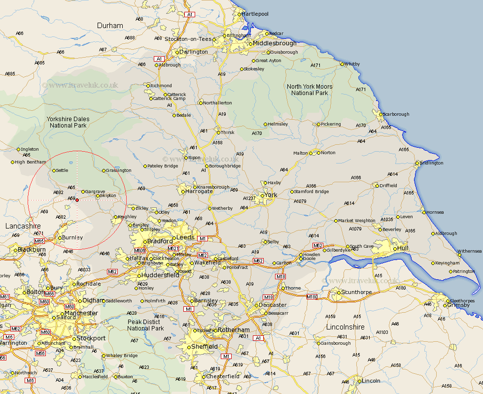
Yorkshire Map Showing Location of East Marton
District: Craven
Easting: 391250 Northing: 450463
Latitude: 53.95 Longitude: -2.13
 = East Marton
Easting: 391250 Northing: 450463
Latitude: 53.95 Longitude: -2.13
= East Marton
This East Marton map below is supplied by Google. Use the tools in the top left corner to zoom into street level or zoom out for a road map, you may also need to zoom in to see East Marton on the map. Click and drag the map to move around. If the map fails to load try and refresh your browser or zoom in or out (+ or -).
Update - it seems Google no longer allow people to use their maps for free! This East Marton map sometimes loads and sometimes gives a error. I am working on a solution.
Closest 30 Towns or Cities to East Marton (Population over 500)
Earby 3.86km Gargrave 4.3km Carlton 5.76km Carleton 5.76km Hellifield 6.59km Skipton 7.86km Cononley 8.49km Long Preston 9.44km Embsay 9.99km Glusburn 10.35km Sutton-in-Craven 12.31km Threshfield 13.48km Steeton 14.11km Giggleswick 14.13km Silsden 14.23km Settle 15.63km Keighley 16.01km Grassington 16.26km Addingham 16.47km Haworth 19.08km Oxenhope 20.56km Ilkley 21.06km Cullingworth 21.3km Bingley 22.58km Wilsden 22.92km Clapham 23.34km Heptonstall 23.52km Hebden Bridge 23.52km Denholme 24.03km Cornholme 24.12km