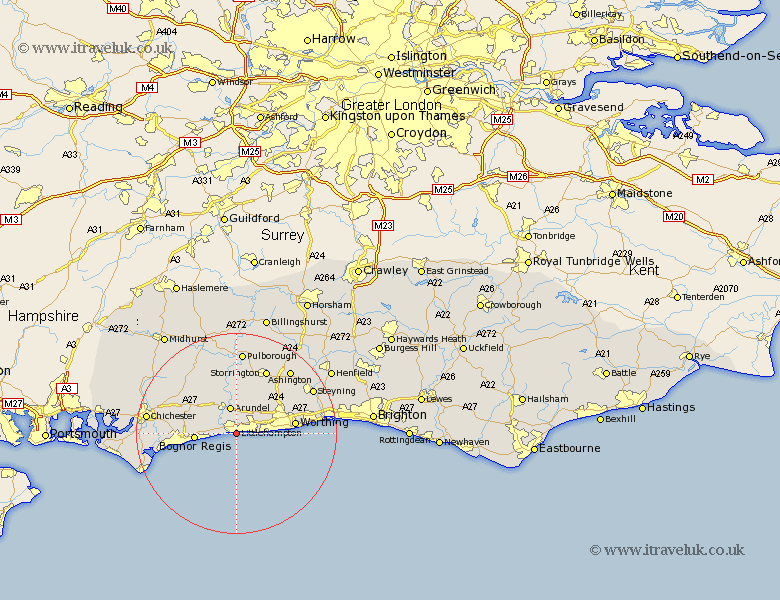
Sussex Map Showing Location of Littlehampton
Population: 49138
Area Size (ha): 1596
District: Arun
Easting: 503345 Northing: 101136
Latitude: 50.8 Longitude: -0.53
 = Littlehampton
Area Size (ha): 1596
District: Arun
Easting: 503345 Northing: 101136
Latitude: 50.8 Longitude: -0.53
= Littlehampton
This Littlehampton map below is supplied by Google. Use the tools in the top left corner to zoom into street level or zoom out for a road map, you may also need to zoom in to see Littlehampton on the map. Click and drag the map to move around. If the map fails to load try and refresh your browser or zoom in or out (+ or -).
Update - it seems Google no longer allow people to use their maps for free! This Littlehampton map sometimes loads and sometimes gives a error. I am working on a solution.
Closest 30 Towns or Cities to Littlehampton (Population over 500)
Rustington 2.34km Angmering 3.97km Ford 3.97km Yapton 4.69km East Preston 5.04km Preston 5.04km Arundel 5.68km Ferring 5.86km West Ferring 5.86km Kingston 6.14km Middleton-on-Sea 6.14km Middleton 6.14km Middleton on Sea 6.14km Barnham 7.27km Westergate 7.56km Walberton 8.07km Bognor Regis 8.23km Felpham 8.41km Bognor 8.41km Slindon 8.96km Eastergate 8.99km Bersted 10.71km Findon 10.89km Bury 11.36km Worthing 11.92km Amberley 12.98km Sompting 13.02km Oving 13.4km Boxgrove 14.03km Tangmere 14.03km