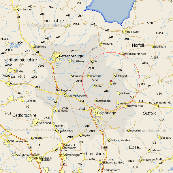
Cambridgeshire Map Showing Location of Chettisham
District: East Cambridgeshire
Easting: 554133 Northing: 282314
Latitude: 52.42 Longitude: 0.27
 = Chettisham
Easting: 554133 Northing: 282314
Latitude: 52.42 Longitude: 0.27
= Chettisham
This Chettisham map below is supplied by Google. Use the tools in the top left corner to zoom into street level or zoom out for a road map, you may also need to zoom in to see Chettisham on the map. Click and drag the map to move around. If the map fails to load try and refresh your browser or zoom in or out (+ or -).
Update - it seems Google no longer allow people to use their maps for free! This Chettisham map sometimes loads and sometimes gives a error. I am working on a solution.
Closest 30 Towns or Cities to Chettisham (Population over 500)
Ely 1.86km Downham 2.16km Littleport 4.34km Witchford 5.85km Stretham 6.51km Manea 9.32km Wilburton 10.05km Mepal 10.34km Haddenham 10.85km Soham 10.86km Sutton 11.9km Wicken 13.17km Isleham 13.77km Chatteris 15.15km Doddington 15.44km Fordham 15.82km Wimblington 16.41km Chippenham 17.22km Burwell 17.28km Willingham 17.55km Colne 17.85km Cottenham 17.99km Somersham 18.47km Earith 18.52km Bluntisham 18.52km Swaffham Prior 18.67km March 19.33km Waterbeach 19.38km Over 20.29km Swaffham Bulbeck 20.42km